Aguas Tuertas | Hiking in the Pyrenees ⛰
By Roberto (Updated Mar 2025)
⏱5 min
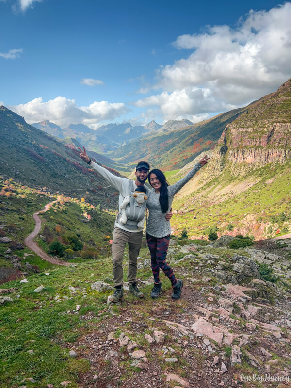
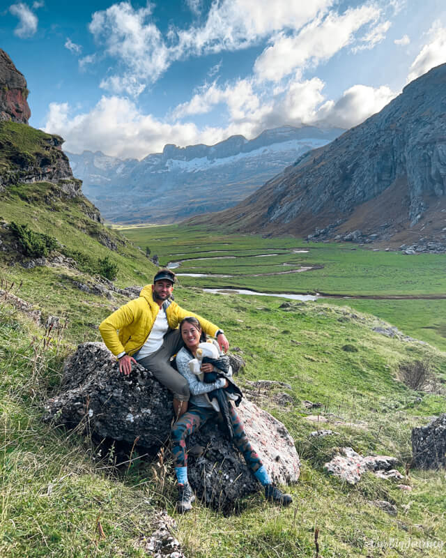
Welcome to another post about hiking in the Pyrenees in Spain! This time we bring you the EPIC hike to Aguas Tuertas Valley, in Huesca. This is a special hike for us because it’s the first one that we’ve done with the new member of the team: Lara 💖.
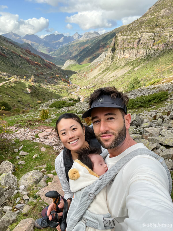
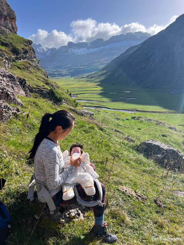
Table of Contents
Why do we like this hike?
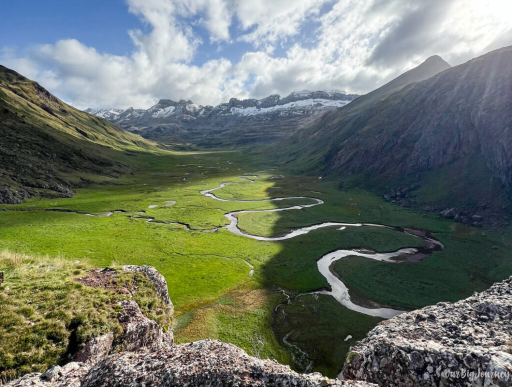
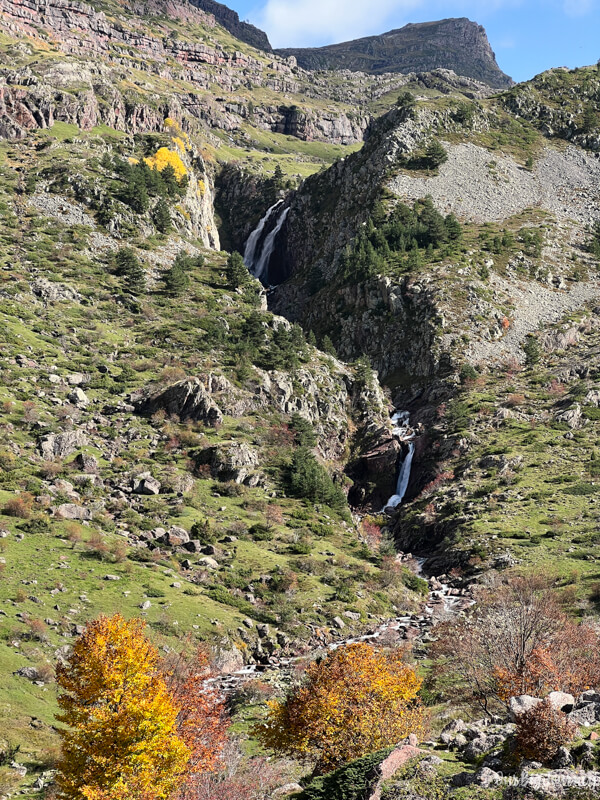
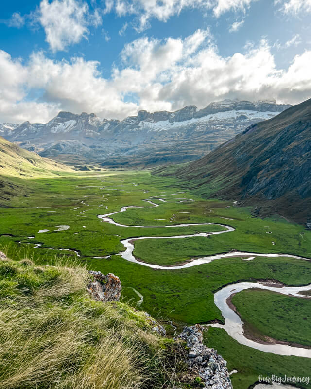
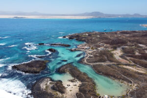
It’s quite a moderately easy walk in the middle of mountains that follows a path until reaching an AWESOME view of a valley with a riverbed with crazy S-shapes. Nature is wonderful there, there are tons of cows, the valley is one of the best ones we’ve ever seen in Spain. Plus, the hike can be extended to a further lake.
I had seen photos of a meandering river across a super green scenery in an open valley and I was wondering if there was some edition with the photos or the place was really like the pics. I told Ellen we had to visit this place and that we could do it with our newborn and… we did it! Read below for all the info 👇
Where is Aguas Tuertas Valley
Aguas Tuertas is a valley in the north of Huesca that connects with the more famous Valle de Hecho (Valles Occidentales) the top left in the map. This was the only region of the Pyrenees that I hadn’t visited before and now I question myself why, because spoiler: this hike is highly recommended.
How to get to Aguas Tuertas
To get to Aguas Tuertas you have to first drive to the starting point of the hike, and then walk for 1 hour 45 mins approx. until the valley.
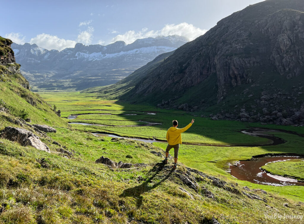
- To get to the starting point of the hike, Parking de la Guarrinza, you have to drive through Valle de Hecho. Passing Hecho, Siresa and Selva de Oza. The last one is a natural space full of pines and beech forests that turn orange and red in autumn, when we went. We also recommend doing a short walk around it, if you visit the area.
- Once you pass Selva de Oza, keep going until you pass a parking area next to a river. Keep going again and the road will become unpaved. Don’t worry because almost all the cars can make it through, you don’t need a 4×4. Don’t be surprised if you find cows 🐄 passing, we found many of them (also during the hike).
The goal is to make it to the Parking de la Guarrinza, the free parking area by the road where people park. When we went we were around 15 cars there. There is plenty of space to park, so parking is not a problem. Once parked, prepare your stuff because the hike to Aguas Tuertas starts.
Hiking Aguas Tuertas
The distance of this hike is around 7 km. That’s the total to walk from La Guarrinza to Aguas Tuertas Valley (where the river makes the S) and the way back. It’s an in-and-out route.
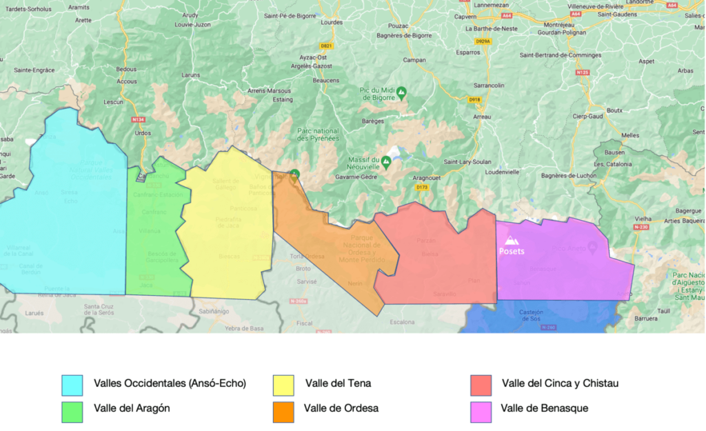
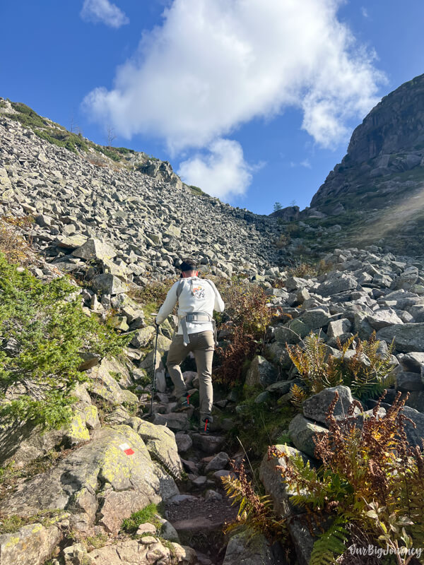
The hike to Aguas Tuertas starts from the parking La Guarrinza and follows the GR-11 for a few kilometers, and it is an easy and clear path that goes up slowly. Except some waters that cross the way, there is no problem in terms of difficulty. After this path, where you can admire the mountains and the River Aguas Tuertas with a waterfall at the back, you’ll arrive to a more steep path, with earth and rocks. Again, the path isn’t technical and doesn’t require a high fitness condition.

Just follow this path until you reach a small shelter for cattle herders 🐮. Here, open and close the gates and after a few more steps, you’ll soon be in Aguas Tuertas Valley. Easy, right?!
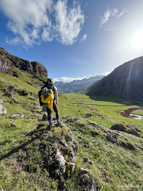
Once you’re in the valley, you can either wander around, go to another lookout where we took amazing photos from, or keep going to a further location (talk about this later).
We recommend to explore the area and find a good point to have lunch or a break. We decided to cross the riverbed, because I thought it was a good idea to get better views… hehe. The thing is that there is no bridge to cross and we had the baby with us. So… what did we do? 😅 Just kick off your shoes and socks and cross the river by foot, of course.
Special tip for photo location
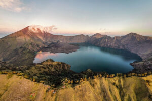
We stopped by some rocks and I could “sense” there was a path that led to the top of a big chunk of rock that I supposed had good views. I went alone there since the path was a bit technical here, and after some minutes, voilà. I arrived to an amazing lookout on a flat area. The views were epic. If you want to know exactly this lookout, message us in social media ☺️.
What if I’m in love with Aguas Tuertas and want to see more?
There is a famous hike that continues all the way to the end of the Valley de Aguas Tuertas to cross it and finally arrive at the Ibón de Estanés. An ibón is a mountain lake. If you google in Wikiloc “Aguas Tuertas a Ibon de Estanes” you can check the route. This one adds another 6 km of distance each way, resulting in a total of +18 km in-and-out. You’ll need a full day to make this one☝️.
And this is all! I hope you visit this place because you’ll always remember the S- Valley.
See you around!
Looking for other hikes in the north of Spain?


Leave a Reply
We'd love to hear from you! Your email is safe with us.